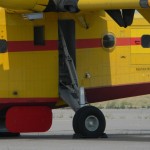
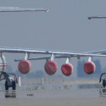
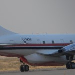
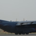
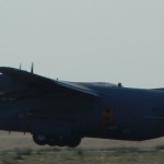
Photos by AAron B. Hutchins, click to make larger:
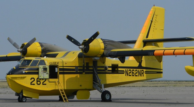
IDAHO WILDFIRES: FIREFIGHTER KILLED IN ACTION! CANADIAN FLYING BOATS JOIN BATTLE.
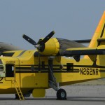
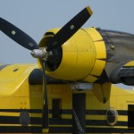
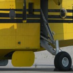
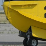
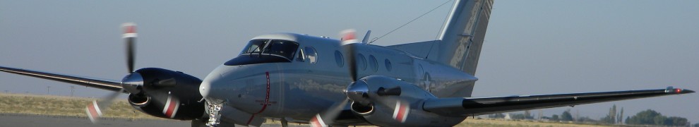
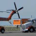
POCATELLO TANKER BASE: SIKORSKY & USMC IN TOWN
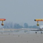
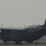
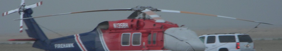
Photos by AAron B. Hutchins, click to make larger:
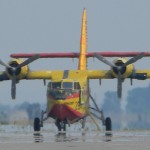


IDAHO WILDFIRES: FIREFIGHTER KILLED IN ACTION! CANADIAN FLYING BOATS JOIN BATTLE.
POCATELLO TANKER BASE: SIKORSKY & USMC IN TOWN
“As of October 30, 2012, 48 states have reported West Nile virus infections in people, birds, or mosquitoes. A total of 4,891 cases of West Nile virus disease in people, including 223 deaths, have been reported to CDC.”-U.S. Centers for Disease Control and Prevention
You can increase the CDC’s West Nile death toll, because the week following the CDC’s latest report Louisiana reported one more human death, along with 13 new cases (two with the potentially fatal neuroinvasive version). The southern state now has 338 official human cases.
Louisiana health officials said one of those recently infected has no symptoms. Officials are pointing out that just because you have no symptoms doesn’t mean you’re not infected. Detection is made only during health exams or when the infected person donates blood.
Oklahoma now reports at least 176 cases, 12 deaths. One 36 years old man has been in the hospital fighting West Nile for three months. He said his only symptom, prior to going into the hospital, was a stomach ache. Veterinarians reporting 39 horse cases, a huge increase. Back in August there were only two horse cases.
On 31 October, it was reported that Maine has its first human case of West Nile virus. Health officials say the person recovered.
Pennsylvania reporting two more cases. County health officials blame climate change: “It was mostly due to the weather. The warm, dry conditions were perfect for the culex mosquitoes that carry the virus.”-Karen Tobin, Erie County West Nile virus coordinator
As of 30 October, Alabama reporting 41 cases. That’s based on data from U.S. Department of the Interior/U.S. Geological Survey (USGS).
The problem is that the USGS West Nile virus map is inaccurate. Here’s an example why: At the end of August Montana reported three new cases in Yellowstone County. Yet, the USGS map, as of 30 October, still does not show those three cases. It only shows cases in Chouteau, Custer, Prairie and Richland counties!
At the end of October, an Emmett, Idaho, man was hospitalized with the neuroinvasive type of West Nile. That makes 16 human cases for the gem state.
Idaho seems to be in the middle of the northwest West Nile outbreak. Here’s what the surrounding states are reporting: Montana has at least eight cases. Wyoming reporting at least seven cases. Utah reports at least five cases (as of 17 October). Nevada reports seven cases. Oregon three cases, the latest case got infected in Idaho. Washington four cases, two from out of state (they didn’t say where).
Officials in Oregon remind everyone that mosquitoes can survive in cooler weather: “Our climate here in Eugene is very mild, so we have mosquitoes seven, eight months out of the year. That season is almost over, but not completely over.”-Patrick Luedtke, Lane County Public Health
Health officials in Nevada also reporting increased number of infected mosquitoes. However, the latest West Nile survivor says climate conditions are not right for mosquitoes, and he never saw any: “I don’t remember seeing water in that wash hardly at all. I’m from the South, so I’m used to mosquitoes, and that’s one of the reasons why we like it here because there’s not a lot of bugs and stuff.”-Leslie Petrasich, Las Vegas resident for past six years
There are many other victims who’ve reported not seeing any mosquitoes, or not remembering if they were bit.
As of 02 November, California reports 38 new human cases. The golden state has 377 human cases, so far 15 people have died. Health officials also report 21 horse cases. 11 dead birds were positive for the virus, bringing the total to 1,614 dead birds with West Nile. Chickens used to test for disease (called sentinel chickens) are continuing to show West Nile is not finished. 15 new cases showed up in sentinel chickens, for a total of 507 cases. Two new cases of infected squirrels, for a total of 21 squirrel cases. Mosquito testing shows no end in sight for West Nile; 22 new positives, for a total of 2,814 positives.
In Grand Junction, Colorado, voters will be deciding if they want to pay an extra tax to fight West Nile virus. It’s called measure 5B and it directly affects property taxes: “For every $100,000 of property that’s assessed, their taxes will raise $12.04. This is a never ending tax.”-Sandra Parker, opposed to new tax
As of 29 October, the Colorado Department of Public Health and Environment reports 129 human case and three deaths.
Texas, the state with the most cases, reporting 1,683 human cases (77 deaths). Recently, some West Nile victims asked local health officials why they didn’t start mass spraying against mosquitoes sooner. It was revealed that the CDC recommended spraying back in July, but local officials didn’t start spraying until almost a month later. In Texas, a county judge must authorize such an operation. The judge for Dallas County says local health officials said nothing to him about aerial spraying until 06 August.
Texas also has at least 72 horse cases.
As of 10 October, the USDA Animal and Plant Health Inspection Service (APHIS) reports 400 horse cases across the country. That’s a 372% increase over last year! Only seven states seem to be unaffected by equine West Nile virus.
On 02 November, a South Dakota news source published an interview with a researcher who said the West Nile epidemic is all about climate change: “We look at accumulated temperature and moisture conditions. Temperature affects the rate at which the virus amplifies in bird populations. When the mosquito bites the bird and acquires the virus, it goes into the mosquito’s stomach. There’s a time lag before that mosquito is infected and can retransmit. So when we get an early spring, transmission starts early. Warmer than normal temperatures reduce this extrinsic incubation period in the mosquito. Then there are more cycles that occur in mosquito and bird populations, more opportunity for the infection rates to build up to higher levels before summer and the disease spills over into the human population. And of course you need water, you need rainfall, or, more specifically, you need puddles, water on the ground for mosquitoes to breed in. But the moisture link is tricky because different types of mosquitoes breed in different types of water bodies. [example] Culex tarsalis is not a floodwater mosquito, so it doesn’t necessarily bloom in population after a huge rain.”-Mike Wimberly, South Dakota State University
In Nebraska, a retired professor reported that overall mosquito counts there were actually down from prior years. He says what is happening is the climate change is killing off many mosquitoes, except for the ones that carry West Nile. It seems climate change is favoring the virus carriers, vectors are on the increase: “There were more positive mosquitoes even though we’ve had fewer mosquitoes than the previous two years…..The mosquitoes that were here were the bad ones.”-Randy Lawson, mosquito hunter
One of the major problems in detecting West Nile cases is that current tests can confuse other diseases, such as St. Louis encephalitis and dengue fever, because they are so similar. An Arizona professor says he has the answer; plants: “Our test will improve the accuracy of diagnosis, leading to the proper treatment of patients affected by WNV. The plant derived monoclonal antibody we examined is not only low cost, but highly specific for WNV antigen and does not recognize antigens from other flaviviruses.”-Qiang “Shawn” Chen, Arizona State University
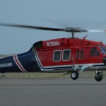
Click pics (by AAron B. Hutchins) to make bigger:


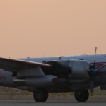
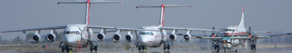
IDAHO WILDFIRE UPDATE, 12 SEPTEMBER 2012: ANOTHER SMOKEY DAY, MORE AIR TANKERS ARRIVE AT POCATELLO TANKER BASE. EVACUATIONS IN EFFECT!
12 September 2012
“Large fires Washington, Oregon, Montana and Idaho made significant acreage gains over the past 24 hours. In Washington, the Barker Canyon Complex burned more than 75,000 acres, and the Apache Pass fire burned 10,000. The Dutch fire in Montana grew by nearly 16,000 acres, and the Mustang fire in Idaho burned an additional 8,400 acres. About 14,500 firefighters and support personnel are currently assigned to large fires across the country.”-National Interagency Fire Center statement
There haven’t been any new fires reported in eastern Idaho, but there are still major fires burning throughout the state, and region. More privately run air tankers have landed at Pocatello Tanker Base (Pocatello airport), including a second BAe-146-200; tanker 40 of Montana’s Neptune Aviation (leased from Tronos in Canada).
Click pics (by AAron B. Hutchins) to make bigger:


There are now nine large fires burning throughout Idaho.
Halstead Fire: More than 150,000 acres (60,702.8 hectares), evacuations in effect.
McGuire Complex Fire: More than 25,000 acres (10,117.14 hectares), evacuations are in effect.
Mustang Complex Fire: More than 289,000 acres (116,954.15 hectares), area closures are in effect.
Porcupine Complex Fire: More than 17,800 acres (7,203.4 hectares).
Powell SBW Complex Fire: More than 42,000 acres (16,996.79 hectares), area closures are in effect.
Sheep Fire: More than 21,600 acres (8,741.2 hectares), evacuations are in effect.
Skull Fire: New fire 35 miles northeast of Roundup.
Trinity Ridge Fire: More than 146,500 acres (59,286.44 hectares), area closures are in effect.
Wesley Fire: More than 3,800 acres (1,537.8 hectares), residences are threatened.
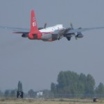
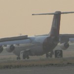
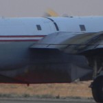
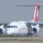
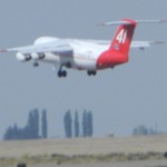
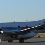
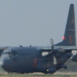
IDAHO WILDFIRE UPDATE, 11 SEPTEMBER 2012: MORE CANADIAN AIRCRAFT ARRIVE AT POCATELLO
11 September 2012, a large and new firefighting aircraft has been seen flying in and out of Pocatello airport (Pocatello Tanker Base) the past few days. It’s a British Aerospace (BAe) 146 flown by Neptune Aviation of Montana (leased from Tronos in Canada).
Click pics (by AAron B. Hutchins) to make bigger:


The use of the BAe 146 has been delayed in the United States, due to complaints filed by U.S. aviation companies that do not want the competition from the 146. The disputes are being reviewed by the U.S. General Accountability Office (GAO).
The latest update is that Neptune Aviation’s tanker 41 has been given a contract to help fight the fires, from 01 September to 09 November 2012.
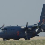
IDAHO WILDFIRE UPDATE, 10 SEPTEMBER 2012:

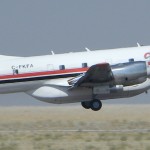
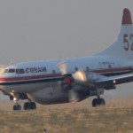
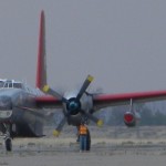
….and tanker 40. Photo by AAron B. Hutchins.
CANADA JOINS THE FIGHT AT POCATELLO TANKER BASE!
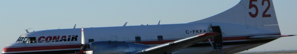
10 September 2012, the smoke just won’t go away, ’cause fires just keep poppin’ up! So far, the year to date fire retardant used by fire fighting aircraft out of Pocatello airport (aka Pocatello Tanker Base) is 261,797 gallons (991,009.4 liters).
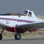
Little “seeders” 802 Air Tractors are the backbone of airborne firefighting operations out of Pocatello airport, but Neptunes, MAFFS C-130s and now Convair CV580 operated by CONAIR of Canada, are making appearances at the tanker base.
Click pics (by AAron B. Hutchins) to make bigger:

According to the National Interagency Fire Center, there are new fires in Idaho, Washington, Oregon, Nevada and Wyoming. There are currently 34 large wildfires burning through the United States.
Idaho has seven large fires, with 640,881 acres (259,355.3 hectares) burned! California has nine fires, but with fewer burned acres, at 151,988 (61,507.36 hectares).
The most recent fires here in eastern Idaho were the Flint Canyon Fire south of American Falls, West Menan Fire and the Pickering Fire near Rexburg.
Regarding the now notorious Mustang Complex Fire, recently officials said the fire was so hard to get to that it would probably burn until the first heavy snowfall of winter!
The Mustang Complex Fire, burning along the Idaho/Montana border, increased by 20,000 acres (8,093.7 hectares) on 09 September 2012. Mandatory evacuations were ordered. The fire is now the single largest in the United States, at 281,000+ acres (113,716.6 hectares)!
EAST IDAHO WILDFIRE UPDATE, 29 AUGUST 2012: BURN AREAS BECOME DUST FARMS.
“We’re ready to go. We’ve gotten the clearance from the governor. We’ve got the state disaster emergency declaration done. Now, it’s just a matter of getting a mission assignment from the Bureau of Homeland Security.”-Colonel Tim Marsano, Idaho National Guard
Can you believe that? Even Homeland Security is calling the shots for firefighters!
16 August 2012, in eastern Idaho the new human caused Fox Hill Fire, close to Wyoming, has burned at least 250 acres (101 hectares). Fire officials say buildings are threatened, but they don’t expect to have any containment until 18:00 hours on 17 August.
Click pics (by AAron B. Hutchins) to make bigger:


Click here to see pics of the last time MAFFS C-130s were at the Pocatello Airport.
On 15 August, the human caused Gun Range Fire, near Idaho Falls, burned about 588 acres (237.9 hectares) before being contained.
Fires are so numerous in Idaho that the Idaho National Guard is being called into battle. According to the Boise based National Interagency Fire Center, there are at least 12 fires in Idaho (NBC news says 9, but they’re wrong), and only one is contained (yesterday’s Gun Range Fire)!
The only other state with as many wildfires is California. Altogether, at least 60 wildfires are currently burning in the United States.
It looks like this year will beat last year’s number of wildfires, already the acreage burned this year is 1.5 million more than last year (currently 6.3 million acres or 2 million hectares have burned)!
I have been amazed by the number of people here in southeastern Idaho, who are just now noticing the smoke. Some don’t notice it until I point it out to them, like “Hey, didn’t you notice you can’t see the mountains anymore?”. The response was “Well now that you mention it…”
While coming out of the Fred Meyer yesterday I overheard two people commenting about how smokey the sky was. Hello! It’s been that way for more than a week now! Oh well, just reminded me of the days when I lived in southern California and was amazed how many people there couldn’t seem to tell the difference between a smoggy day and a clear day!
Besides Idaho and California, the other states dealing with wildfires are: Arkansas, Arizona, Florida, Montana, Nevada, New Mexico, Oklahoma, Oregon, Texas, Utah, Washington and Wyoming.
TWO NEW WILDFIRES IN EASTERN IDAHO

Click pics (by AAron B. Hutchins) to make bigger:


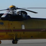
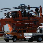
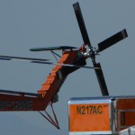
EAST IDAHO WILDFIRES 2012: MAINTENANCE DAY FOR SKYCRANE FIRE FIGHTER @ POCATELLO AIRPORT
After weeks of hot dry weather, and lots of wildfires, eastern Idaho gets hit with random thunder/rain storms!
Click on pics (by AAron B. Hutchins) to make bigger:


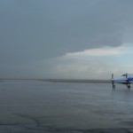


EAST IDAHO WILDFIRES 2012: MAINTENANCE DAY FOR SKYCRANE FIRE FIGHTER @ POCATELLO AIRPORT

Photos by AAron B. Hutchins. Pics get bigger when you click on them:


EAST IDAHO WILDFIRES 2012: CURRENT FIRES FOR 12 JULY
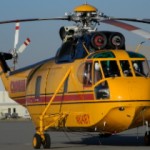
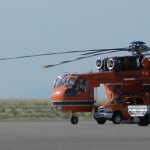
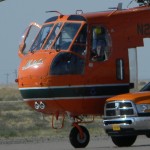
BUSY 30 MINUTES AT POCATELLO AIRPORT, AS FIRE FIGHTING AIRCRAFT FLY INTO ACTION
SIKORSKY SKYCRANE LEAVES POCATELLO AIRPORT FOR COX’S WELL FIRE