09 September 2022 (11:44-UTC-07 Tango 06) 18 Shahrivar 1401/12 Safar1444/14 Ji-You 4720
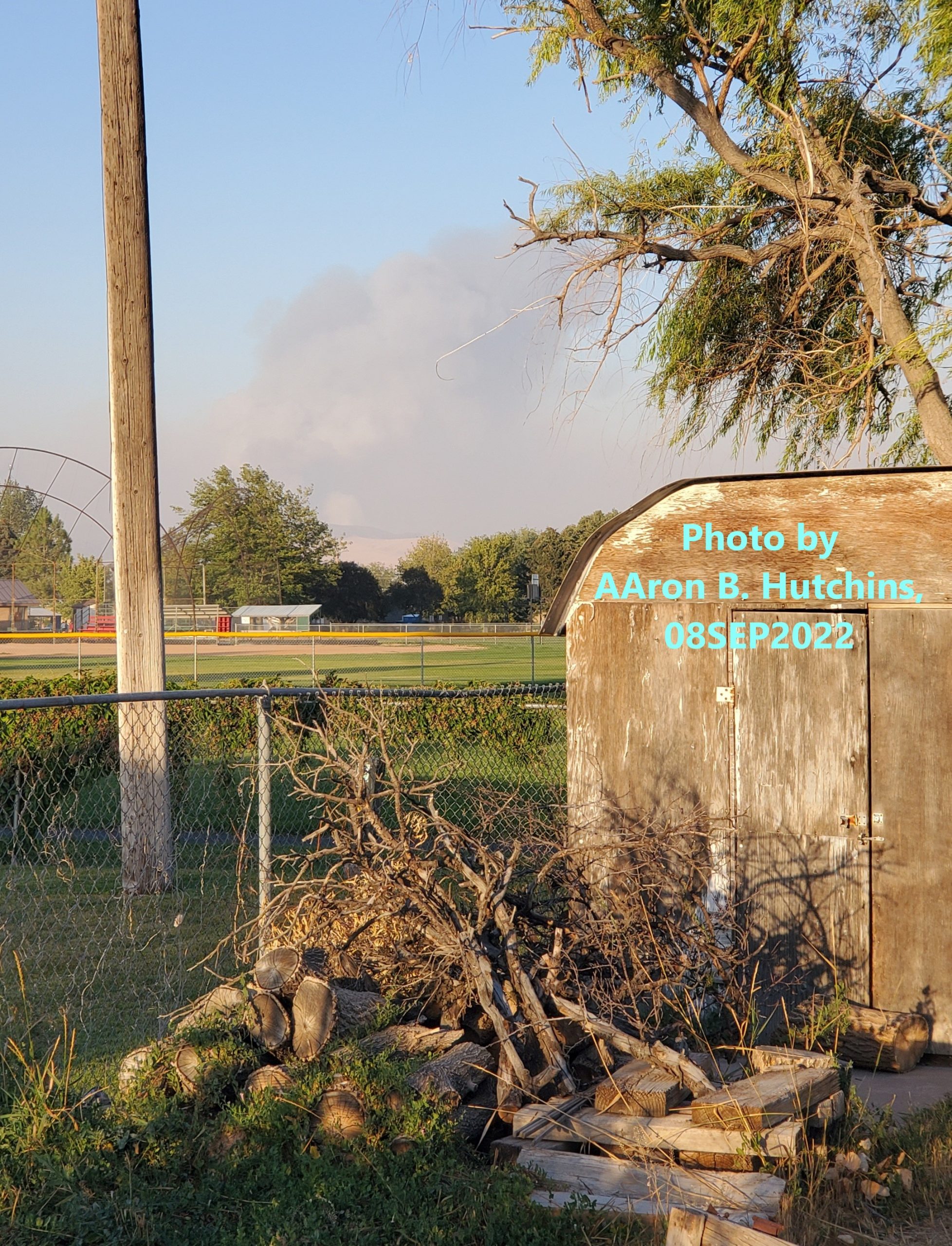
2 & 1/2 Mile Fire, as seen from my backyard in Chubbuck, Idaho.
The wildfire currently called Two and a Half Mile Fire is in an area of Bannock County, Idaho, that has a history of going up in smoke. Just last month, in the same area, north of Pocatello, on Bureau of Land Management (BLM) and Fort Hall Reservation land, was the Ross Fork Fire (not to be confused with a current wildfire of the same name in Blaine County).

Photo via BLM.
Today, a warning has been issued for those using the Interstate 15 highway, around the Fort Hall Exit between Pocatello and Blackfoot, firefighting efforts could result in highway traffic being halted of diverted. The Idaho Fire Information website ranks the fire as “extreme”, an evacuation order was issued to anybody living in the 2 1/2 Mile Road/East Ross Fork area.
The fire has burned at least 7-thousand acres since the afternoon of 08SEP2022. Fast winds during the night made the fire worse, it is zero percent contained. The U.S. Environmental Protection Agency (EPA) has issued a burn ban for federal reservations in Idaho, Oregon and Washington, and the Idaho Department of Environmental Quality (DEQ) issued a Degraded Air Quality warning, and a burn ban for Bannock, Bear Lake, Bingham, Caribou, Franklin, Power and Oneida Counties. The air quality warnings and burn bans are blamed on the numerous fires in the Pacific Northwest.
This is not the first time a wildfire blackened the hills around 2 1/2 Mile Road; 03JUL2013:
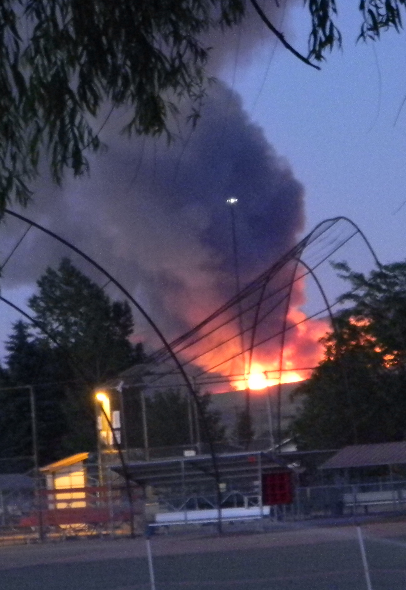
Photo by AAron B. Hutchins, 01July 2013.
2 1/2 MILE FIRE CONTAINMENT, MORE IDAHO FIRES EXPECTED, WARNS OFFICIALS.
June 2012:
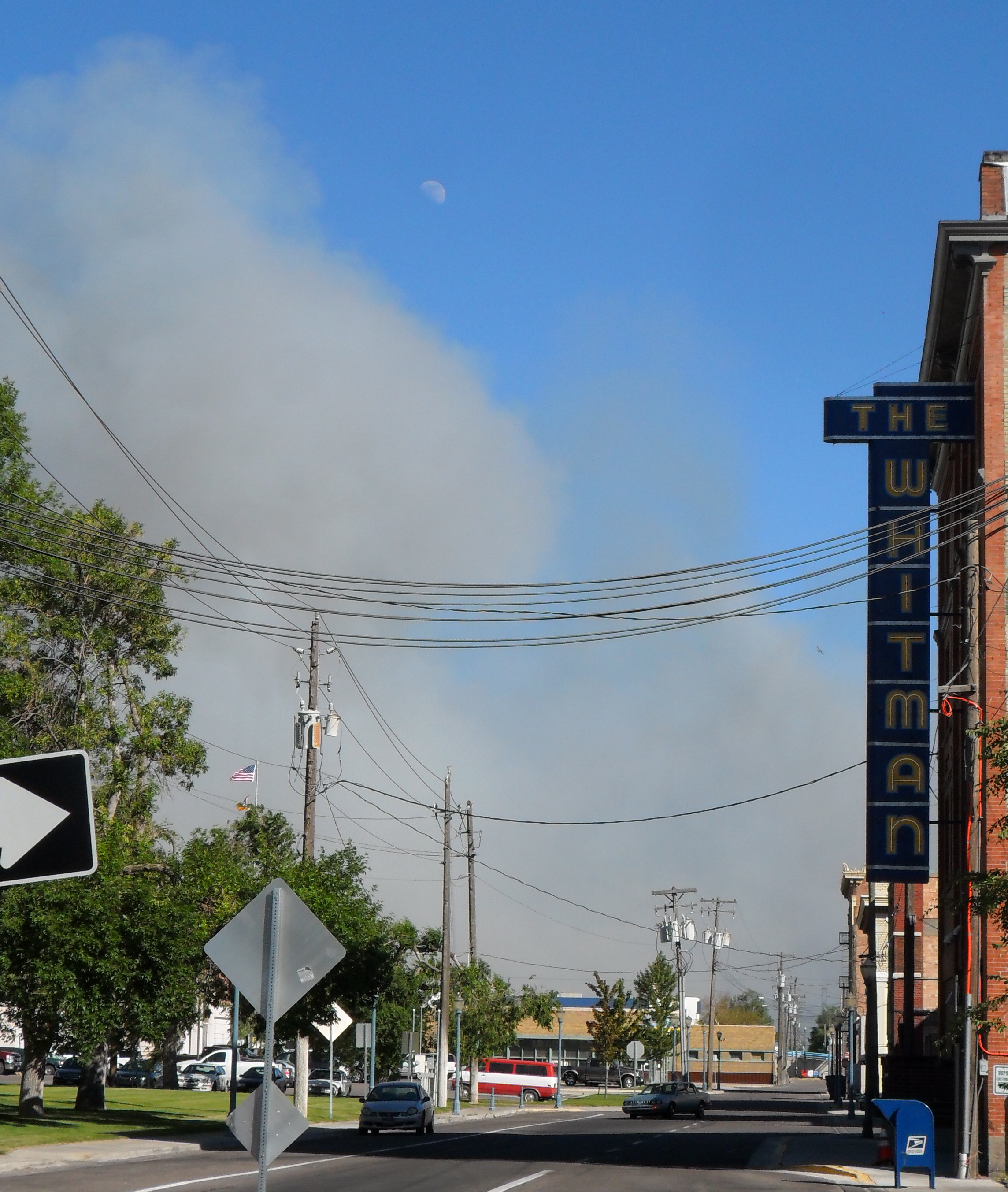
Smoke seen from downtown Old Town Pocatello. Photo by AAron B. Hutchins, 28JUN2012.
POCATELLO CHARLOTTE FIRE STILL BURNING! 66 HOMES NOW DESTROYED!