“It’s always sad to come into an area that looks like a war zone, with so many homes that have been devastated.”-J.D. Ellis, Battalion Chief for Boise Fire Department
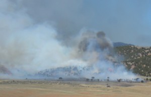
01 July 2012, fire fighters from Boise, Idaho, commented on the Charlotte Fire in Pocatello (in southeastern Idaho), saying the geography and vegetation are quite different from what they’re used to in their area of the Gem State.
“It’s been kind of…a learning experience to evaluate the structures and see which ones survived and which ones didn’t survive and try to identify factors between the two.”-J.D. Ellis, Battalion Chief for Boise Fire Department
As of 01 July 2012, the Eastern Idaho Interagency fire map still shows three active fires in southeastern Idaho: Charlotte, Stockton and 10 Mile Fire.
Charlotte Fire reported as burned 1,038 acres (420 hectares) contrary to what national agency reports say. Stockton Fire is at 1,210 acres (489.6 hectares) and the 10 Mile Fire (aka Ten Mile Pass Fire) is at 1,188 acres (480.7 hectares).

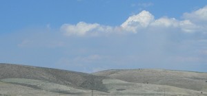
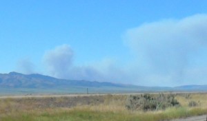
28 June 2012, early stages of Stockton Fire, which actually started north of Banida, Idaho, despite what the media reports say. Farm equipment is blamed.
The 10 Mile Fire reportedly was caused by a agricultural controlled burn that got out-a-control.
Near Boise, in western Idaho, the U.S. Bureau of Land Management (BLM) is fighting a fire that’s burned 1,500 acres (607 hectares) so far. It started 30 June 2012, it’s southwest of Marsing, near Jump Creek Road. Like the majority of fires in Idaho, officials believe it’s human caused.
I could not find the Marsing Fire listed on any interagency maps. The USDA Forest Service Active Fire Mapping Program lists only the Charlotte and Ten Mile Pass fires.
The National Interagency Fire Center is also days behind updating their fire reports.
On 01 July 2012, the National Oceanic and Atmospheric Administration (NOAA) warned of “critical” fire conditions throughout the Pacific Northwest, due to extremely dry air and windy conditions. Humidity levels expected to be as low as 8%!
Idaho’s history includes some intense fire fighting years, starting with the 1910 Great Fire (aka Big Blowup or Big Burn), and then most recently the fires of 2007. Some fire fighting ‘experts’ are already calling 2012 a record year for the numbers of fires in Idaho.
BLM officials are blaming the decades long drought. Lynn Ballard, southeastern Idaho USDA Forest Service official, says a lot of autumn vegetation (they like to call them “fuels”, which also applies to anything that burns) dried out during the dry winter. With the snow melt and few rain storms during spring came more vegetation growth, but that dried out quickly. The result is lots of tinder dry brush, and now we’ve got hot and extremely dry weather.
While the mainstream U.S. news media has been reporting lightning as the main causes of wildfires around the country, not so in Idaho. The overwhelming majority of Idaho wildfires have been human caused, by accident or on purpose.
Federal officials say prior to 2003 most Idaho wildfires were caused by lightning, the increase of human causes they blame on ignorance: “There’s a multitude of things that can lead to a human caused fire, so people just need to be cognizant of the things that they’re doing, of things that have heat that…could start a fire.”– Lynn Ballard, USDA Forest Service
Charlotte Fire 80% contained. Vulture/desperate contractors already descending.

